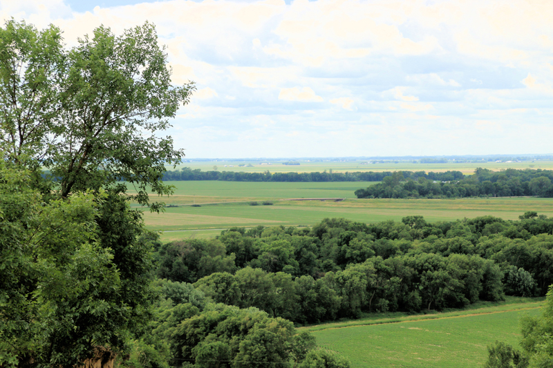
This Missouri Alluvial Floodplain landform is characterized by low relief and periodic disturbance from flooding and forms the southwestern two thirds of Iowa’s border. Like it’s eastern counterpart, the Mississippi Alluvial Floodplain, it was formed from glacial meltwater when rivers carved valleys and partially filled them with layered deposits of gravel, sand, silt, and clay. The region also has a striking eastern border in the Loess Hills, which was created by wind-blown soil (loess) from the Missouri River floodplain. A characteristic of this region is that Missouri River spring floods often inundate low areas, causing soil erosion and deposition, resulting in a channel that historically meandered throughout the floodplain. Channelization has shortened the river, increased the speed of water flow, and greatly reduced oxbow and backwater habitats. Much of the floodplain is row-crop agriculture, although numerous shallow wetlands exist. Nonetheless, this remains a unique landform with respect to its birdlife. Historically, sandbars on the Missouri River hosted breeding Piping Plover and Least Tern, and both species continue as rare breeders. Floodplain forests are dominated by cottonwood and typical breeding species include Yellow-billed Cuckoo, Red-headed Woodpecker, Eastern Wood-Pewee, Warbling Vireo, House Wren, Yellow Warbler, Eastern Towhee, and Orchard Oriole. The intensive row-crop agriculture between the river and the base of the Loess Hills hosts breeding Upland Sandpiper, Western Kingbird, Bell’s Vireo, Cliff Swallow, Lark Sparrow, Blue Grosbeak, and Dickcissel. The few remaining wetlands have nesting waterfowl, Least Bittern, Marsh Wren, and Yellow-headed Blackbird.